FREE! Subscribe to News Fetch, THE daily wine industry briefing - Click Here
![Banner_Xpur_160x600---Wine-Industry-Insight[63]](/wp-content/uploads/Banner_Xpur_160x600-Wine-Industry-Insight63.jpg) |
 ALSO SPONSORED BY: 
Wine Industry Insight Also sponsored by: 
 |
 |
TTB’s Appellation System Dysfunctional, Outdated – Designed for Insiders
“I note, and object to the fact that the application of the petitioner [E&J Gallo] is not publicly available for review and comment. Although certain information is quoted in the [TTB] Notice [#90 to expand the Russian River Valley AVA] any party raising an objection is at a disadvantage when it does not have the full petition and maps available to review.”
–Frank R. Bailey III, Santa Rosa Attorney and Russian River Valley winegrower.
In an age when all U.S. federal courts offer online access to all filings and require every document to be filed as an Adobe Acrobat (.pdf) document, the TTB maintains a mostly paper-based system which, as Bailey points out, prevents all parties in a controversy from having equal access to the same information.
A Wine Industry Insight hands-on investigation has revealed that the fragmented and confusing nature of the information also serves to obscure the full nature of a proposal.
Indeed, if all other AVA proposals are like Gallo’s request to expand the Russian River Valley AVA to include its Two Rock vineyard, then the process and the documents serve only to “pad the file” for a process by insiders and for insiders and not for the benefit of the public or to assist outside scrutiny.
TTB Reserves the Most Important Information For Insiders
The TTB does place its notice and public comments online. But not the guts of the matter: the proposal and maps. It also posts Microsoft Word documents for download. That file format is notorious as a virus vehicle.
Indeed, to view the main proposal, an interested party must travel to Washington, D.C. or make a request under the Freedom of Information Act.
Wine Industry Insight obtained access to a copy of the full Gallo proposal — all 301 pages — and has scanned the entire document. The large document has been split into four parts to make your download (and my upload) more efficient. The TTB charged just over $124 to provide the documents..
The complete proposal is below.
Gallo-TwoRock-TTB-Proposal.pdf
Gallo-TwoRock-TTB-Proposal2.pdf
Gallo-TwoRock-TTB-Proposal3.pdf’
Gallo-TwoRock-TTB-Proposal4.pdf
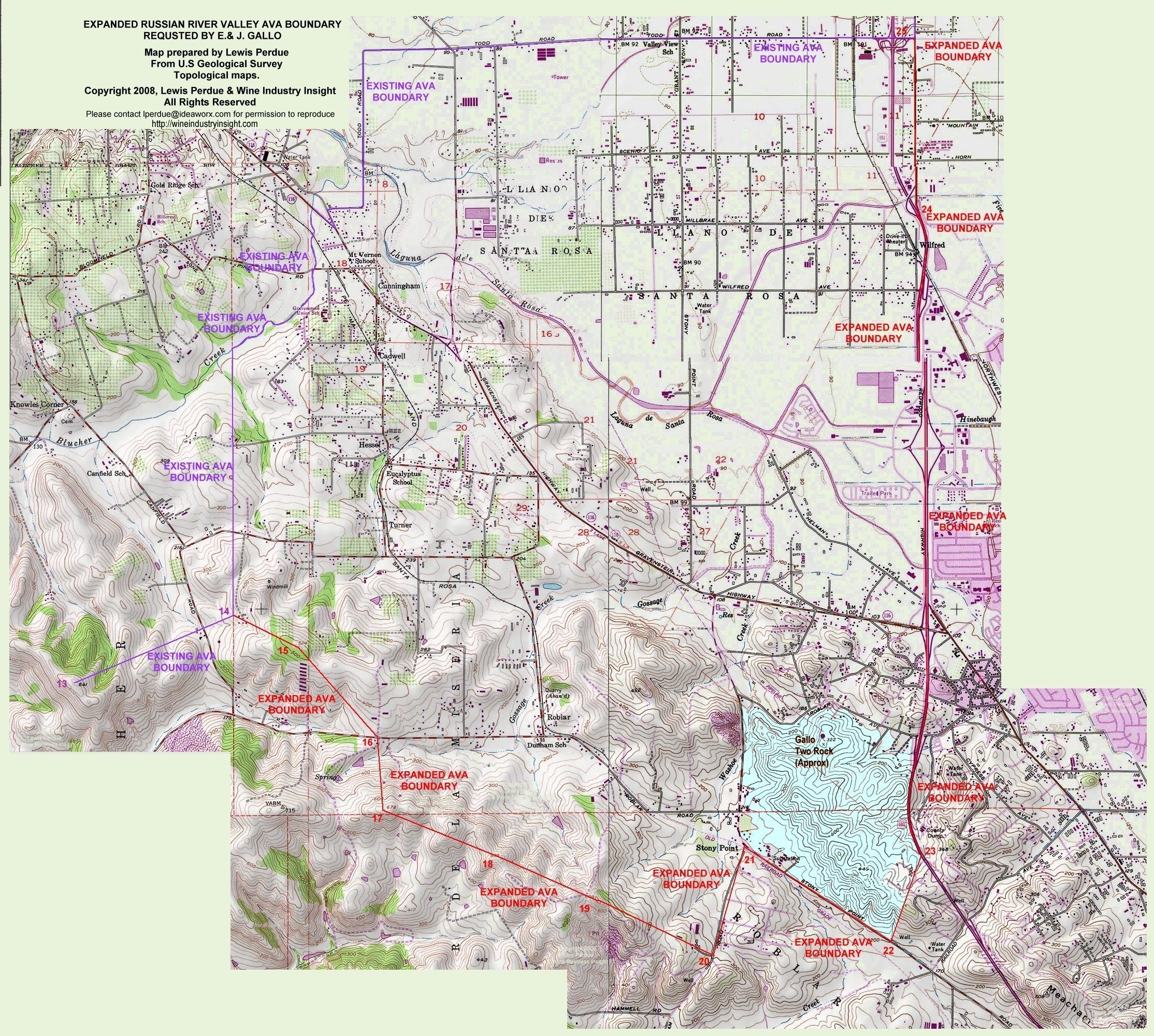
Expansion Boundary Map (Created by WII)
The scanning process took me less than half an hour using a sheet-fed scanner (part of a $200 combo printer/fax/scanner).
WII will be writing more articles as the contents are analyzed.
The Proposal As Provided by TTB Is Incomplete, Lacks Map
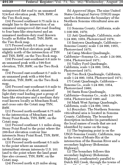
Despite the cost, time and hassle of obtaining an FOIA copy of the proposal, TTB’s spokesman said that they do not maintain maps, even though it requires them to be submitted with the proposal. On Dec. 16, TTB spokesman Art Resnick told WII the maps were maintained by the U.S. Geological Survey.
However, USGS spokeswoman Leslie Gordon told WII, in an email received today, that, “The USGS does not maintain maps of the viticulture areas per se (so we cannot exactly provide a map of the Russian River Viticulture Area), but we do publish the official base maps on which a viticulture area would be described.
“To get a visual image (or map) of the area,” she wrote, “you would need to look at the appropriate USGS topographic quadrangle (topo) maps (listed in the description) and follow the instructions in the written description.”
I wrote yesterday about how confusing, and contra-transparent this is. And, even after driving the area twice, it was hard to accurately visualize what Gallo was asking for.
So, I spent four hours this morning doing something that both the TTB and Gallo should have done.
Not an approximate map such as those in circulation, but a real, honest-to-goodness, detailed map based the Gallo proposal’s impenetrable, topographical mumblings.
The long, anally retentive task of splicing together digitized topo maps and connecting the numbered dots in the aforementioned impenetrable, topographical mumblings gave me an appreciation cartographers.
Creating Map Reveals Arbitrary Boundaries
But it also made me pay close attention to the land, the elevations, the topography, streets, streams and other features. By the time I had finished, it was clear that many of the boundaries that Gallo had proposed and the TTB has accepted were arbitrary, illogical and disconnected to any sort of geographic or topological coherence.
More on this, tomorrow.
 Also Sponsored by: Also Sponsored by: |
Real Estate
Legacy Family Vineyard, Howell Mtn AVA – Ultra-Premium Organic Cab & Zin, Winery Potential, 2 residences. 33 acres + water.For more information, please click here to contact Robyn Bentley... April 14th, 2021BentleyAd-042121For more information, please click ad to contact Robyn Bentley... April 11th, 2021Winery and Vineyard Real Estate Market Rockin’ & Rollin’ in Southern Mendocino County and Northern Sonoma CountySpecial to Wine Industry Insight By Todd Sheppard, www.TEAMSHEP.com Disclosure: The author is a real estate agent... October 21st, 2019NEW REAL ESTATE COVERAGE: You’re only as far away from dirt as your next glass of wineGrowing up in a farming family, the household mantra to city folk was that, “You’re only as far... September 5th, 2017MORE REAL ESTATE |
|
|